
Distance: 119km | Climbing: 1,437m – Click here for GPS Route
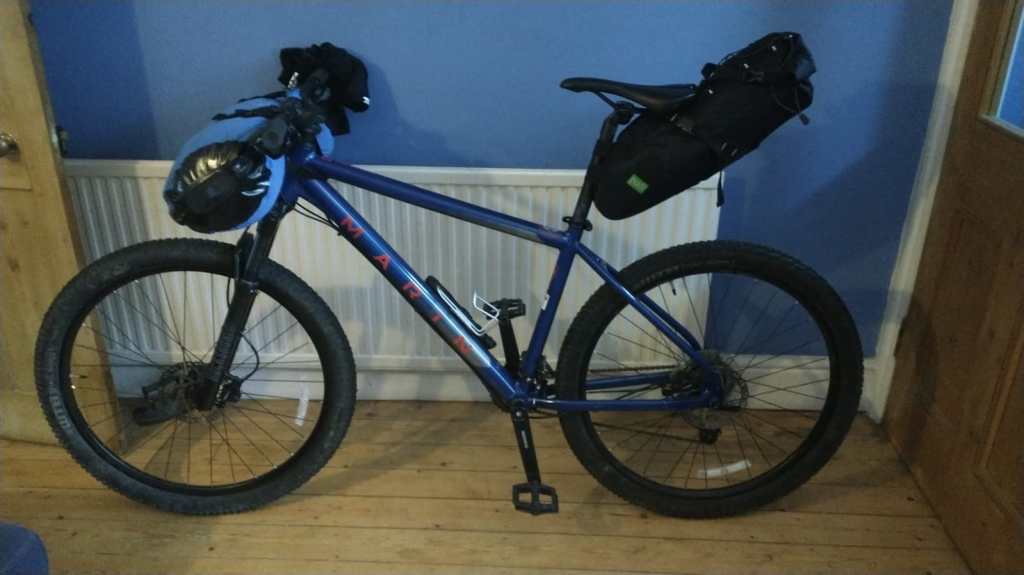
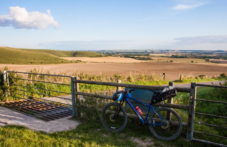
So, how was I going to fit all my camping, cooking and bicycle gear into two ridiculously small bikepacking bags and a backpack? Put simply, I wasn’t. There was no way it would all fit. But thankfully, I was rescued from my own ill-preparedness by a Winchester-based cycling friend and highly experienced cycle tourer, Julian. He had completed the King Alfred’s Way earlier in the year and upon meeting him on my arrival in Winchester, he immediately offered me a loan of a much larger handlebar bag. I was able to stuff my bulky Decathlon two-man tent into this, along with some other items, freeing up just enough space in my backpack and seatpack for everything else.
This wasn’t the first time Julian had rescued me from my own poor planning and decision making. In the last stages of my world cycle, I had arrived into Winchester on a bicycle that was lurching horribly from side to side. My rear wheel had begun to fall apart, with multiple spokes breaking and the rest loosening at an alarming rate. I was stopping every hour to crouch beside the buckled wheel and re-tension the remaining spokes in an effort to make the wheel look a little less Pringle-like and delay its inevitable collapse.
There was no way that wheel was going to take me the remaining 600 kilometres to my hometown of Limerick, but thankfully that’s where Julian stepped in. He had a touring-specific wheel which he very kindly gifted me, which was perfect for the job and got me those remaining kilometres back home. Needless to say I was grateful for his help again here, which made packing and loading the bike the evening before my departure a much easier task.
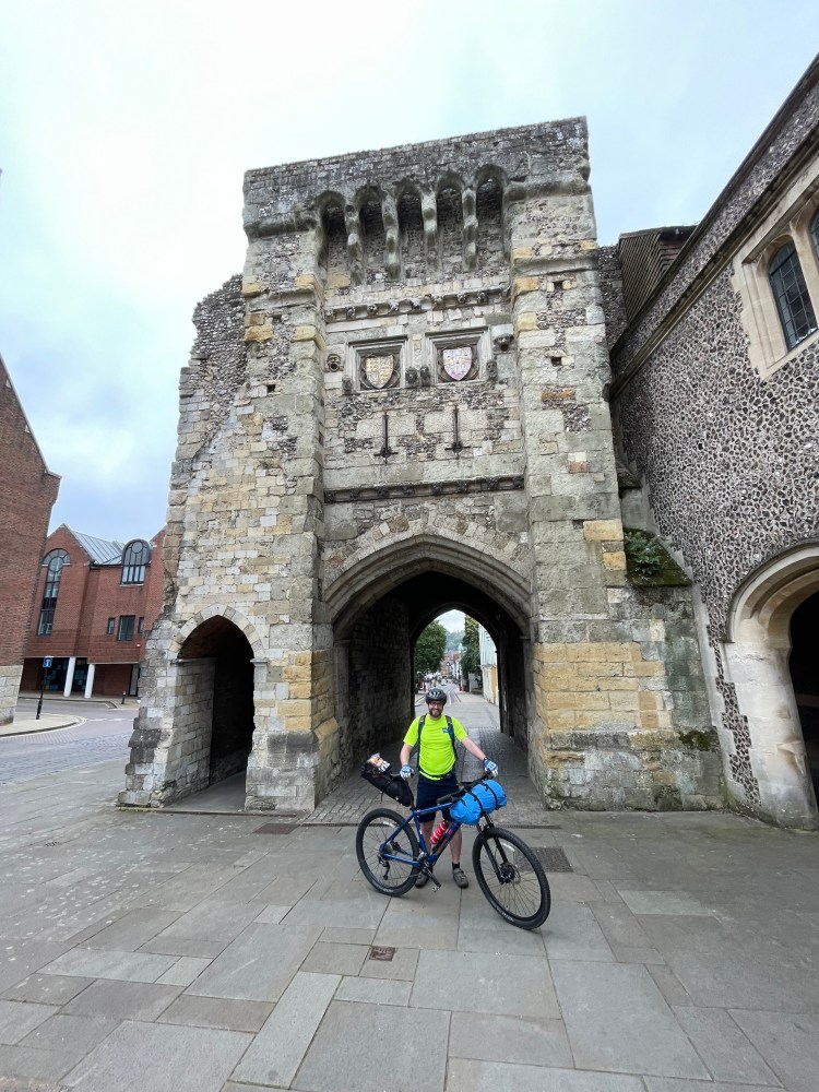
The next morning, I met up with Julian again at the official start of the King Alfred’s Way: Westgate, a fortified gate from the 12th century that was once part of Winchester’s ancient city walls. After a few ceremonial photos from Julian to mark the start, we set off out of town together with him leading the way along a series of quiet backroads.
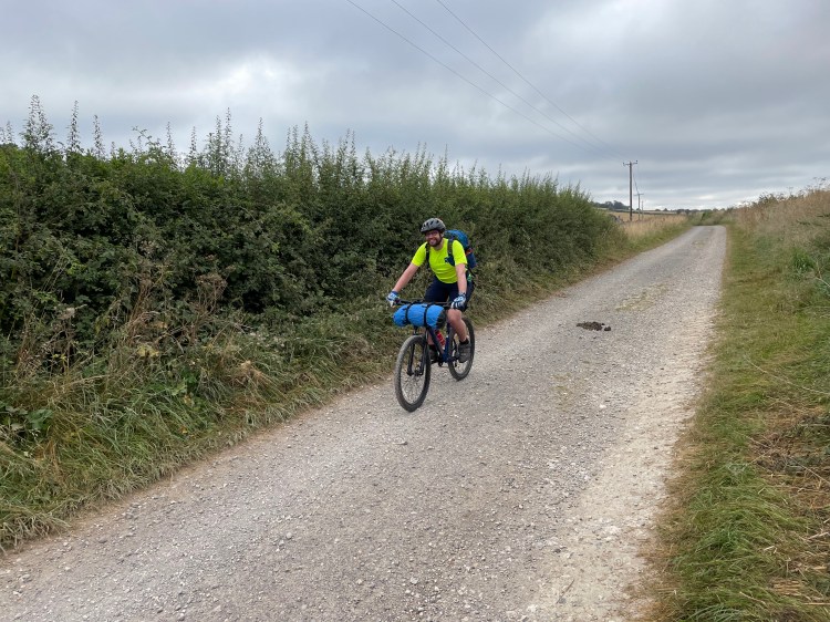
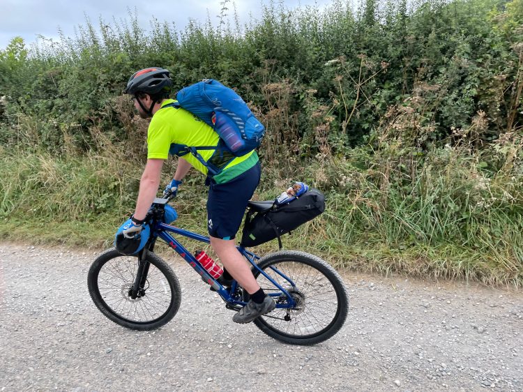
The next twenty kilometres were spent struggling to keep up with Julian as we flew along a mixture of backroads, gravel tracks and dirt singletrack. We passed the time chatting about our various cycle tours and our future travelling plans, Julian chatting calmly and me trying to chat back in between my ragged breathing, my fitness paling in comparison to his.
Thanks to Julian’s company though, the time flew and before I knew it we had reached the point where he was set to turn back to Winchester. I thanked him for guiding me out of Winchester – which had made the morning’s start far easier navigation-wise – and for his great company and conversation, allowing me to properly catch up with him for the first time since the global pandemic had limited our ability to travel as we pleased.
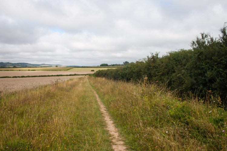
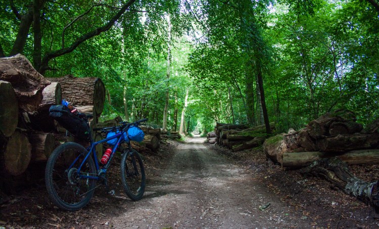
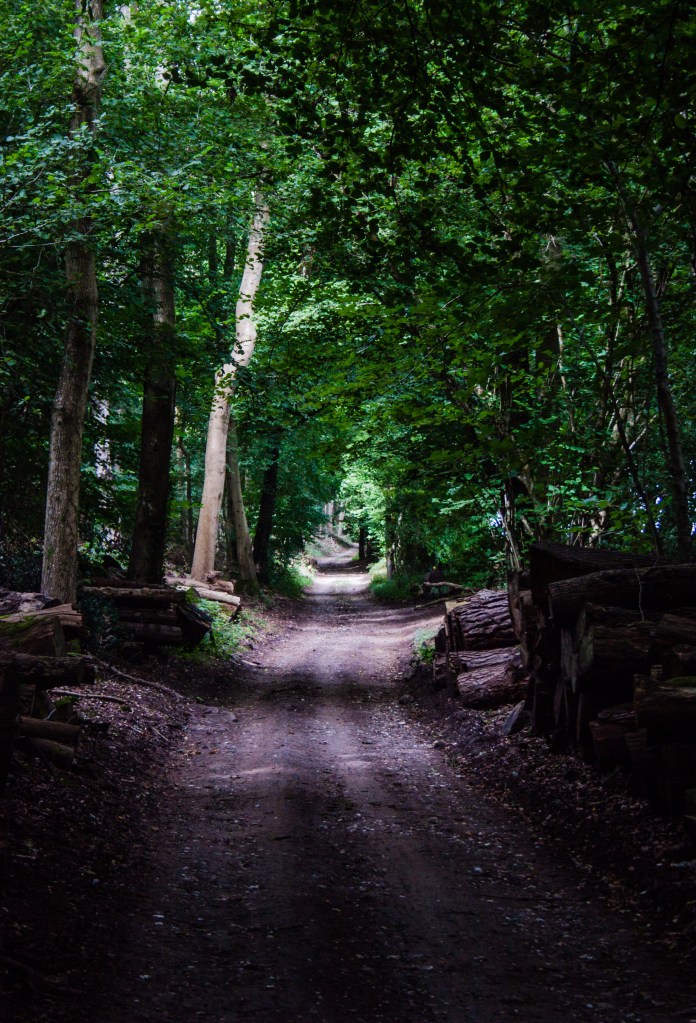
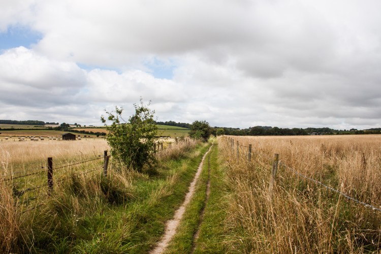
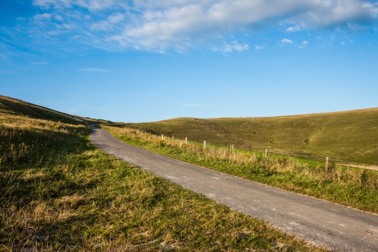
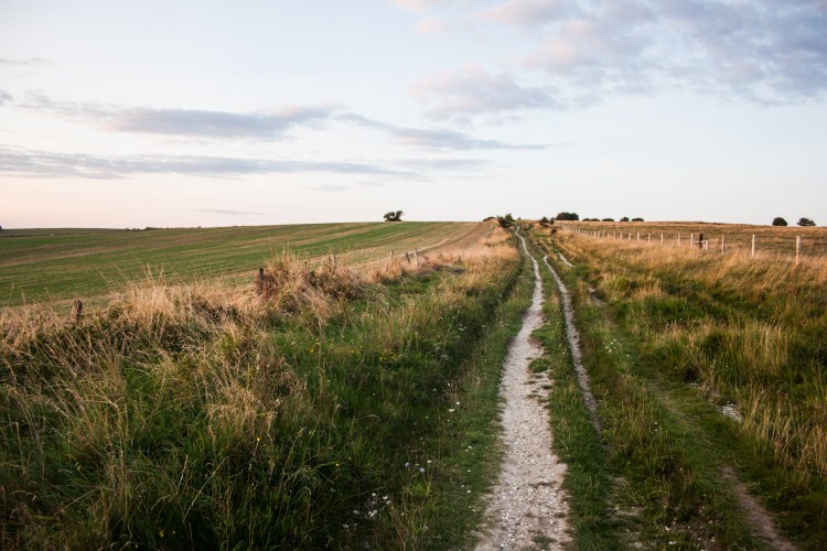
With Julian turning back in the village of Broughton, I began a steep, rutted climb through a thick plantation. From there I would spend the majority of the next twenty kilometres off-road as I tackled a mix of forest fire-roads, woodland trails and farmland singletrack.
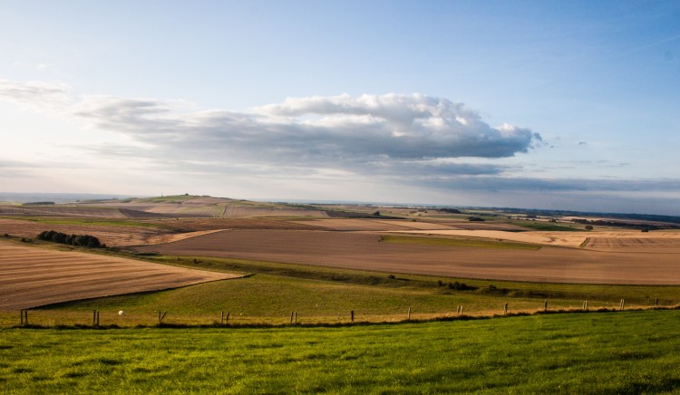
Over the course of these twenty kilometres, I could not get over just how peaceful this route was. Here I was, passing through one of the most populated regions in all of the United Kingdom, yet I barely saw a soul. I sat back and eased into a nice relaxed pace as I soaked up the tranquility of the forests and farmland I was pedalling through.
I was rudely shaken out of my peaceful trance as I reached one of the main roads leading into Salisbury. The route avoids this busy town, so all I had to do here was cross this road and I would be back to the peaceful country cycling again. Yet I was stuck there for nearly five minutes waiting for the slightest gap in the stream of traffic that was speeding in both directions.
When the smallest of gaps finally did appear, I didn’t need a second invitation. I sprinted across the road as fast as I could and got the hell away from Salisbury faster than a Russian tourist.
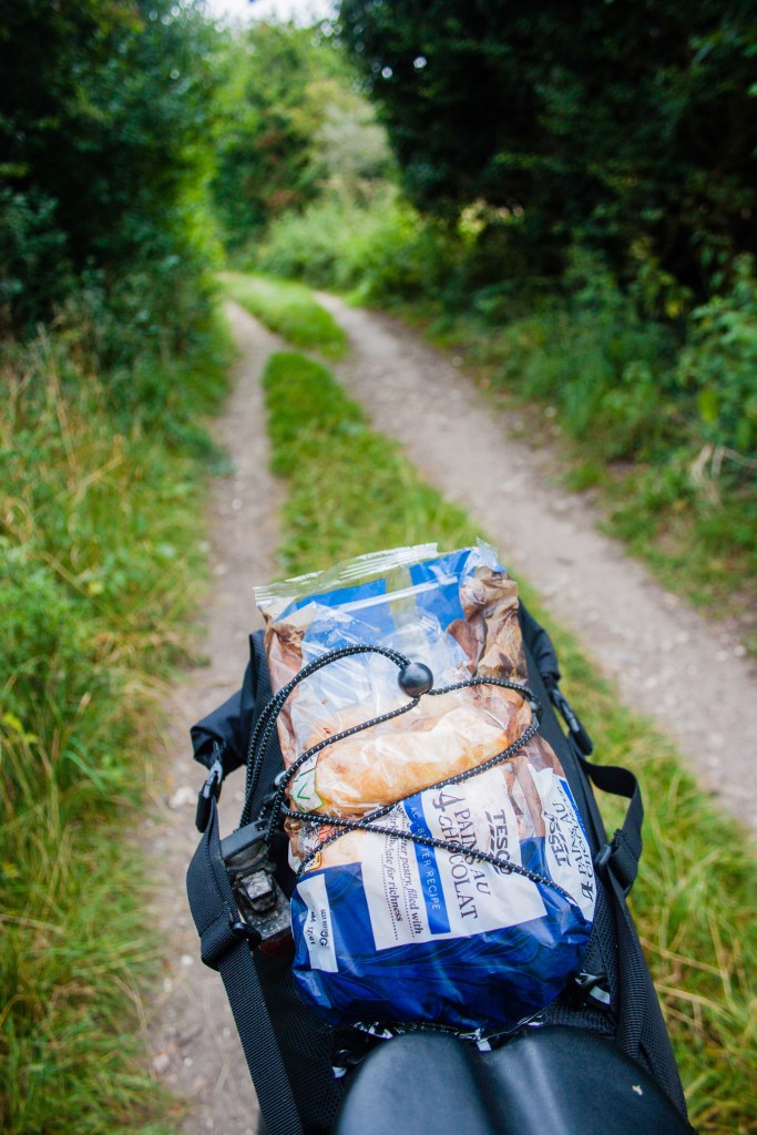
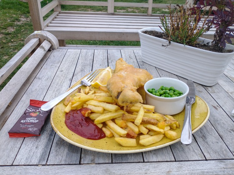
Once past Salisbury, I continued on backroads for another five kilometres until I reached a turn off for The Bridge Inn, a country pub situated on the banks of the river Avon. This was too tempting to turn down, so I took a short detour off the official route to stop in here for a cheeky fish and chips. My legs and back were struggling slightly as this was already the toughest cycle I had done in the previous eight months, so this rest was very much welcome. I wasn’t even halfway through the distance I had initially planned, so I knew this was going to be a tough day.
Feeling absolutely stuffed, I forced my bloated body back onto my bike and set off back onto the route, slipping past the architectural marvel of Stonehenge on yet more singletrack.
I had initially thought that the route would bring me right past Stonehenge itself, but some bad planning meant that I wasn’t aware you actually needed to detour slightly to see it. The mystery of why they built Stonehenge would elude me yet gain it seemed.
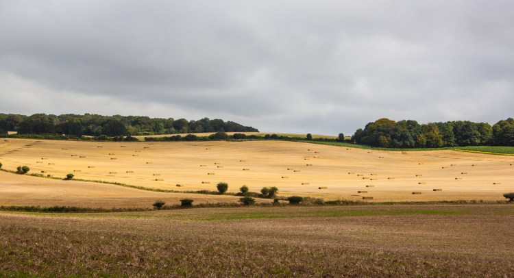
Just north of Stonehenge, I started cycling through some of the military land which occupies a large portion of the Salisbury Plain. I had heard from others that if a red flag was flying from the flagpoles along this section, that I would get to see and hear shells exploding as well as live gunfire. Unfortunately there were no flags flying on the day that I passed, and I was just left with the sounds of birdsong and swaying branches in the breeze.
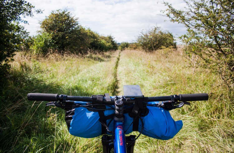
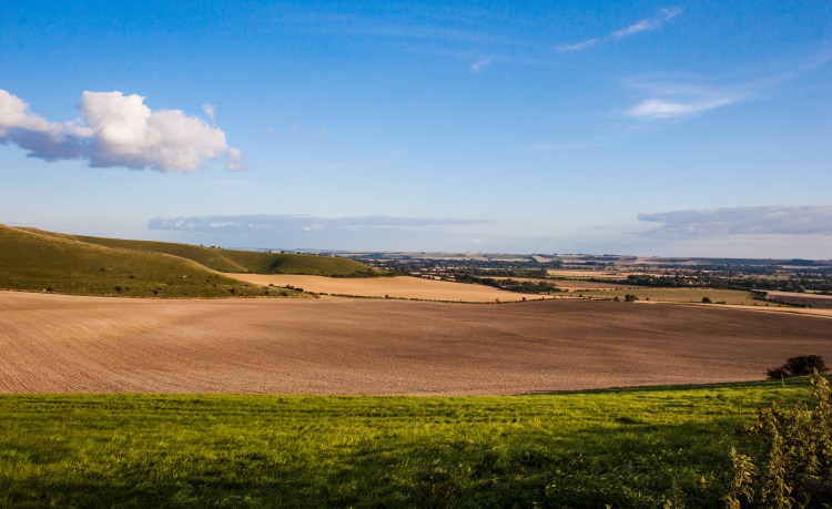
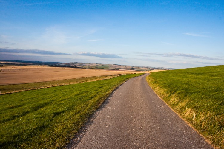
Even when I reached the wide, gravel tracks that traverse this land, I didn’t come across any of the speeding tanks which I’ve heard the military use for training exercises around here. Instead, I crunched through the gravel in silence, racing northwards away from the Salisbury Plain, towards the Vale of Pewsey.
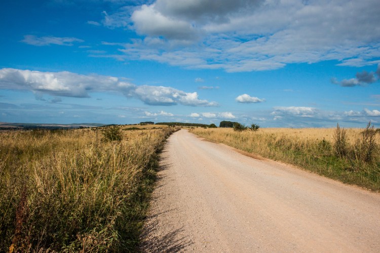
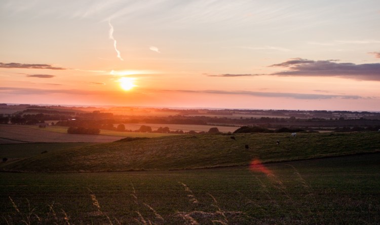
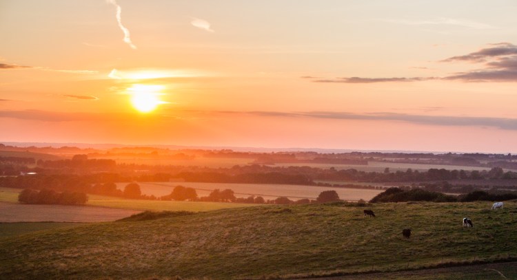
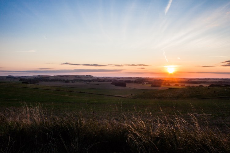
The Salisbury Plain gave way to a steep climb over the shoulder of Tan Hill. I already had 100 kilometres in the legs at this stage, a distance I hadn’t cycled in nearly a year, so this climb proved to be a real struggle. I zig-zagged my way up the steep tarmac, spinning in the granny ring as I sweated my way upwards. Yet, the sweeping views and the fact that it was now the golden hour – that perfect hour before sunset where the landscape glows splendidly – made the struggle completely worthwhile.
By the time I had reached the summit I was running on empty. Yet, I knew that I had to get to the village of Avebury so I could fill up with water before finding somewhere to wild camp in the countryside on the far side of the village.
This made the next descent quite tense. It was a rutted 2.5 kilometre piece of singletrack which required the utmost concentration. The slightest movement of the bars would send the side of my tyre against the side of the rut and if I was going fast enough, the next thing I would know I would be sitting upside down in a ditch.
This descent was a real struggle as I was just too tired to concentrate properly and nearly came off the bike a couple of times. When I did make it down off the side of the hill I raced along backroads into the middle of Avebury.
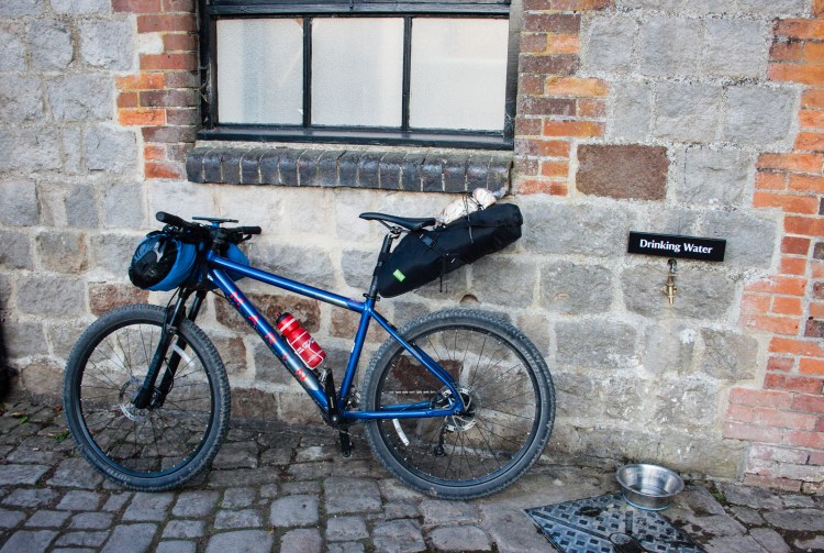
Avebury was your typical quaint English village with the added bonus of a Neolithic stone circle in the midst of it. I didn’t have too much time to look around, however. I made a mad dash around the village, looking for some drinking water. Thankfully I found a label with those exact words by the closed café beside the stone circle. I quickly filled up and then sprinted out of Avebury in the twilight, beginning my climb up onto the Ridgeway, an ancient trackway and trading route which mostly follows ridgelines as it traverses 140 kilometres of the English countryside.
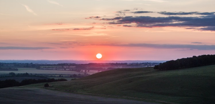
Although I had felt totally spent on my descent into Avebury, the necessity of climbing into the hills surrounding Avebury in order to find a suitable wild camping location had given me a second wind. I sprinted uphill along gravel tracks with the sun setting brilliantly over my left shoulder. Although I was a bit worried about finding somewhere to camp before dark, I couldn’t help but stop and take a few photos of the magnificent view behind me.
For the next ten kilometres I checked out various potential camping spots, but they weren’t as well hidden as I would like. I have always been very particular about where I wild camp when travelling alone, much preferring to camp somewhere that I will be unlikely to be seen or found. Having heard plenty of stories during my travels of people having been robbed or assaulted after being discovered by undesirables while wild camping, this is something I have always been very disciplined about. Even though those stories were nearly all from countries with a slightly rougher reputation than England, it was one of those principles I always did my best to follow, even in safer countries.
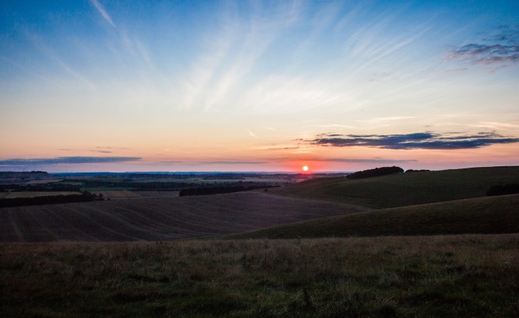
This meant that I was still pedalling my slow way along the gravel of the Ridgeway as the sun sank below the horizon and darkness began to fall around me.
In the end it simply became too dark to keep going, so I had no choice but to settle for a patch of grass maybe thirty metres of flat grassland away from the trail. I pitched my tent here in the dark, using just the light of my phone, and jumped inside, absolutely exhausted. I had brought a stove and cooking gas with me, but I simply did not have the energy to cook up a full meal in the darkness using just my phone’s light, especially considering the 119 kilometres of mostly off-road cycling I had just covered.
With the tent set up here, I knew I would be completely visible from the trail, but I was on a more remote part of it now, called Smeathe’s Ridge, which was pretty far from any towns. I thought it would be very unlikely that anyone would come past here until morning time, by which time I would be packing up. So, surely I wouldn’t be disturbed overnight. Surely!
